
DFW VISUAL FIELD GUIDE
Curated Photography Destinations Across Dallas u0026amp; Fort Worth
SIX PLACES TO START
Top 6 Verified Photography Locations in DFW
Each selection pairs a photographic opportunity with the official source to check before you pack a tripod, schedule a portrait session, or plan a longer location day.

Botanical u0026amp; gardens · Verified location
Dallas Arboretum
Work seasonal color, formal garden lines, and quiet close studies early in the day. Review photography etiquette before setting up.
Parking notes and access guidance are subject to current visitor operations.

Historic · Verified location
Fort Worth Stockyards
Frame western facades, passing street scenes, and the cattle-drive atmosphere. Morning gives the district room to breathe.
Check the visitor guide for current event activity, access, and parking details.

Urban u0026amp; skyline · Verified location
Klyde Warren Park
Use the park as a foreground for the Arts District’s changing forms, people-moving-through frames, and city scale.
Best light shifts with the surrounding towers; review park rules before a planned shoot.

Architecture u0026amp; water · Verified location
Fort Worth Water Gardens
Concrete planes, descending lines, and reflected light reward a patient study of scale. Controlled light is the visual advantage here.
Consult official permitting information for current photography and park requirements.

Architecture u0026amp; bridge · Verified location
Margaret Hunt Hill Bridge / Trinity Overlook
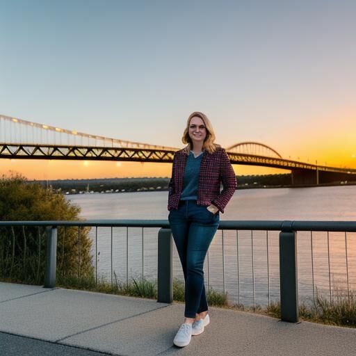
Trace the bridge’s cable geometry into skyline layers, then stay for a twilight sequence as the city lights take over.
Access conditions along the Trinity corridor can change; verify your approach before departure.

Canals · Verified location
Mandalay Canals at Las Colinas
Look for waterline reflections, bridge rhythms, and an evening atmosphere that works well for long exposures and detail frames.
Use the official guide to confirm current visitor information and area access.
ORIENTATION BEFORE DEPARTURE
Interactive Regional Corridors u0026amp; Travel Times
Use this as an orientation map, not live navigation: Dallas, Fort Worth, Las Colinas, and the Trinity corridor are shown alongside the TRE commuter rail, I-30, and Northwest Highway. Traffic, event schedules, and access conditions can change the shape of a shoot day.
Plan by corridor, then verify on site
Open the field notes for practical regional context. For restrictions, parking, and property-specific rules, always defer to the official location source.
TRE commuter rail
The TRE is a useful east–west orientation line between Dallas and Fort Worth and may be practical for selected urban segments. Confirm current service, station access, and equipment policies before relying on it.
I-30 corridor
I-30 is the principal Dallas–Fort Worth connection for a combined-day plan. Build in contingency time for traffic and use the route as a planning reference rather than a fixed travel promise.
Northwest Highway
Northwest Highway helps connect northern Dallas movements and can shape an approach to garden or cross-city stops. Review your chosen location’s parking and arrival guidance before departure.
Drive times u0026 parking
Treat drive times as variable. Check event calendars, parking instructions, and official visitor information on the morning of the shoot, especially when moving between city centers.
Drone airspace tips
Verify current FAA, airport, municipal, park, and private-property restrictions before flying. Do not assume that a photographable location is drone-permitted without official confirmation.
PUT THE GUIDE IN MOTION
Curated 1-Day Photography Itineraries
Two deliberately paced routes for working with changing light. Check official access, parking, and event conditions before you leave.
Dallas Architectural u0026amp; Skyline Circuit
Begin with garden calm, move into architectural scale, and finish with layered skyline light as the city turns from twilight to night.
Sunrise — Dallas Arboretum
Use first light for seasonal color, formal symmetry, and quieter paths. Review the official photography policy before arrival.
Midday — Arts District
Shift to hard urban geometry, façades, and shade-to-sun contrast. Keep the route flexible around programming and street conditions.
Golden hour — Pedestrian Bridge
Work bridge lines and long shadows as a transition between close architectural frames and broader skyline views.
Twilight — Margaret Hunt Hill Overlook
Settle into bridge structure and layered city light. Confirm access and parking conditions before committing to the final position.
Fort Worth Heritage u0026amp; Water Circuit
A progression from geometric water and concrete to heritage streetscapes, museum forms, and Exchange Avenue’s illuminated evening character.
Sunrise — Fort Worth Water Gardens
Arrive early for controlled light on concrete forms, water movement, and Dallas headshots that make a strong first impression, just like [link] geometric compositions. Check current park guidance first.
Midday — Stockyards Cattle Drive
Work the district’s western architecture and street energy around the cattle-drive atmosphere; consult the visitor guide for current schedules.
Afternoon — Kimbell Museum
Use the museum district for measured lines, changing shadow, and a quieter architectural study. Respect all property-specific photography rules.
Blue hour — Exchange Ave neon
Finish with illuminated signs, storefront texture, and evening street scenes. Recheck parking and event conditions before the final stop.